Sandy and I did this hike May 9th, 2015.
This hike was amazing. We left Calgary at 6:00am, making it an early morning and a long 3 hour drive. I had the smart idea to bring champagne for when we reached the summit (my first one ever and Sandy’s first one of the season). I had a hard time trying to figure out how to keep the champagne cold until we drank it (I will explain how I did it below the gallery).
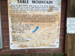
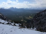
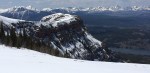
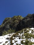
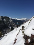
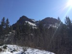
When the mountains came into sight, they were white as if a fresh blanket of snow were laid on them. The sun was out and there was not a cloud in the sky, perfect day for hiking… The parking lot we used was off to the right, hard to miss when driving into the campground. For those who are unfamiliar with the area, the trail begins on the west side of the lot. We accidentally did the interpretive loop, so it added some time to our hike.
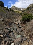
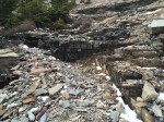
Once we were on the correct path (and after a few choice words that we were dumb enough to not find the trail…), it wound through birch and aspen trees by a rather quick creek. When the trees gave way to the creek, you could see flooding had recently occurred; there were lots of fallen and uprooted trees and rocks scattered nearly up to the path.
The path was well worn and well washed out in areas. Roots were great for footholds as we climbed steeply in sections (in the snow, which was quite unpleasant). It was tiring with a 50lb pack on (champagne, ice, frozen things… ugh).
On the first small level(ish) section, the path appears to split in two (which we later found out, that while it appears to, the correct path is on the RIGHT… not the left… which is clearly marked… on the right). We took the left path thinking that it was the correct on! Wrong.
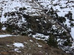
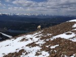
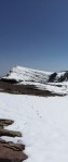
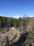
We descended a bit through steep rocks, then climbed again and came into a LARGE alpine meadow; filled with snow… and rocks… and shrubs of all kinds which were also flowering. This brought lots of giant bumblebees (which were oddly enough, orange, not the typical colourings we see in Calgary) which loved to see what we were doing in THEIR territory. We had one follow us for a good 10, 15 minutes; it was kind of comical.
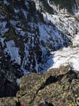
Shortly after getting into the clearing, we lost the path that we were supposed to be following (snow, remember?). We could see mountain goat prints, and so we decided that it would be a grand idea to follow those for a bit since they also led towards the direction we were going (again, probably not the best, but hey; it was warm, sunny, no wind… perfect). The footprints led us up a hill, and halfway down the other side where the gully was clearly visible. I had printed off a small contours map and trail guide to help us along our way. According to the map (which is incorrect), we were on the right path (which turns out wasn’t actually a path, but more a spacing between the shrubs that appeared to be a path in the snow). The goats came this way, so why couldn’t we?
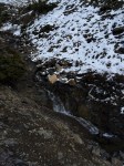
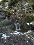
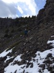
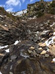
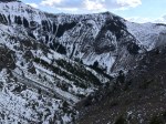
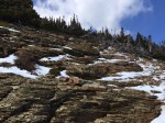
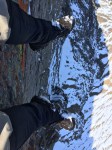
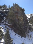
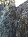
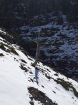
We started out going up, rather steeply, the mountain from our lovely alpine meadows. We wandered around shrubs and boulders; making our way up… straight up… It must of been made for extremely fit people because we had to stop every 20 feet to catch our breath. It was horribly difficult in the snow. There were sections that I could of sworn were at 75 or 80 degrees; it was that hard (ok, maybe it was only 60). But, we managed to get to the first visible section from below. The large waterfall from the creek.
While Sandy took a small break, I wanted to see what this waterfall was about. I traversed the rock ledge to just in front of the falls (these falls weren’t exactly falls, but water trickling down a rock face). There was a deep crevasse in the side that went in probably 10 feet that the water ran down the walls in. It was nice. This was where a tree decided that it liked my sunglasses and took them from my coat. It took me a minute to find them.
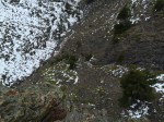
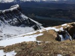
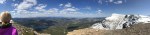
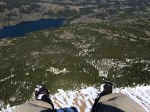
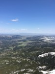
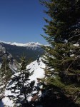
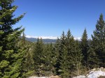
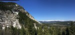
Once back up to Sandy, we followed the goat trail more. This time, Billy (the goat), decided he would like to tour us up a small, narrow, path through rocks. This was our first bit of a scramble and it was rather easy. At the top, there was a nice picture vantage point that overlooked the valley we just climbed up. Ahead of us was more of the same terrain; lovely.
We followed the trail Billy had laid out for us. It was rather quick and direct and somewhat vertical; he wasted no time getting to the top. We crossed the creek and climbed an even steeper hill. At the top of this monster, we took a small break only to realize that little hill we just climbed was the easy part. We looked at what we had to do and we both groaned. Luckily, Billy must of known we would follow him because he took us on a slight detour; around the other side of the mountain. We didn’t get very far before we realized he was going in the wrong direction (what does he know! He’s a goat!). We turned and went straight up (because our leg’s weren’t tired enough). This section was very difficult; the high altitude, the burning leg muscles, the heavy breathing… It felt like we were being punished for something.
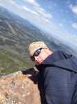
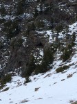
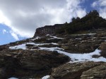
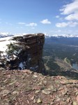
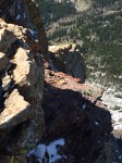
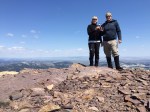
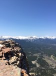
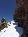
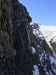
Finally, we reached the cliff face. They rose above us, taunting us as if to say “you can’t climb up us!”. We followed them all the way North until we almost ran out of mountain (Billy’s trail had reappeared by now, so we knew we must of been on the right track!). There was a small opening in the cliff face, just large enough for us to climb up (and I thought it was relatively easy compared to what we just went through). Once we got most of the way up, we could tell (finally), that we had reached the summit (yay!). We made our way to the edge and celebrated with some champagne (which was still so cold we couldn’t hold the bottles for longer than a few seconds).
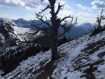
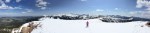
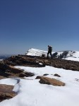
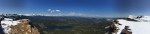
We ate our lunch and laid in the sun. It was so warm and NO wind. We were quite surprised considering that area is known for the wind! After a bite to eat, we left our bags and wandered around the top. Seeing the different views and just enjoying the top. When we looked out across at the summit next to us, we could see small tiny white things moving on the peak. We had finally spotted Billy! But he wasn’t alone; and as it turns out, Billy wasn’t really Billy… Maybe a Beatrice.
With champagne in our system, we decided that it would be a nice quick trip to the other summit so off we went! Looks are very deceiving. We started up, making sure to follow Beatrice’s trail because we knew there was small overhangs of snow. The small hump in between the two summits looked small but was actually just as steep as the stuff we climbed up. This wasn’t going to be a quick 10 minute jaunt.
Once over the hump, the trail darted through the trees. It was met by some kind of cat tracks, my guess was a lynx since it was too high for other mountain cats (if someone knows something different, please do share!). Once through the trees, it dropped fast onto a small land bridge (again, full of snow). The path to the summit was actually quite easy. It was gradual, not slippery, and the scenery was amazing. We could see our lovely goat leaders just a few minutes away.
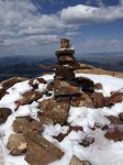
As we approached, they were more concerned with the vegetation than with us, so we were able to get quite close (enough to hear them breathing and eating). When they finally wondered who we were, they dashed off; we continued on to the summit. Someone had tried to build a small mound of rocks; so I neatly organized it into a pathetic looking Inuksuk. It marked the summit. Back down we went.
By this time, the snow was melting (it was hot, +15C up there). So you know what that means… Snowball fight! Which was great and all, but little did I know, my phone slipped from my pocket and landed on the ground. We walked away and made our way back to Table Mountain to grab our packs. When we got back, there was another group of hikers who were eating their lunch. We chatted for a few minutes. The one guy asked which way we came up because he didn’t see our tracks. We pointed to the small dip at the top and said we climbed up the trail. He chuckled and said “that’s not a trail”. Sandy and I looked at eachother and laughed. No wonder it was soooo difficult! The guy commented and said that it was probably the Climbers route that climbers take in the summer. We asked what path he came up and he pointed behind us (back towards the second summit) and said there’s a marker just over there.
We packed up and I was going to take one last picture; but I had no phone to do so. I started to panic, knowing exactly where it probably was. Sandy wasn’t impressed; neither was I. BACK to the second summit we went. We ditched our bags just below the marker for the path down so we knew where to come back to and proceeded to climb what we had just come down from; looking for my phone all along. No phone. We started across the land bridge again and Sandy had stopped for a break; I continued on. Made my way up to the second summit and there was my phone – laying in one of my boot prints, about 1/3 of the way up the summit. I grabbed it and made my way back to Sandy who had already started back.
We made it to our bags (after nearly collapsing from all the walking back and forth up the same hill). We grabbed our packs and headed down the trail (which was well marked). This side of the mountain was completely different than what we climbed up on. It was steeper, more loose rock, and more mud. It was very slow going. We met up with the creek after traversing across the steep landscape and followed it nearly all the way down. We then branched off and headed up (shudder) only to turn around and head down the other side of the small (but large) hill. This path was VERY well marked and very well used.
There was one point where we eventually met up with the fork in the path (that we accidently took). We were commenting on how poorly marked the entrance for the trail was until I turned around. There was a bright orange marker tape hanging in a tree (which was probably covered when we came through that area in the morning!). By this time, we were exhausted. Our feet hurt, our legs burned, and we didn’t want to go any further but knew we had to. It felt like it took forever to get to the car; almost double the time it took to get up the hill (probably because we were so tired).
We hopped in the car and left Beaver Mines Lake.
In Summary:
Some guides list this as an easy hike, some list it as an intermediate. The path we took made it a difficult hike. The path on the way back would of made it an intermediate if we took that path up and down. It was a nice hike and had a great reward. The second summit was quite nice too and only took an extra 1.5-2 hours to do (once).