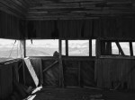
This hike was completed on Sunday, June 5, 2016. Present company: Sandy, Curtis, Ryan, Sheldon, Nick, Chris and myself. We decided to do this hike for two reasons: 1. It was in a different area than what we have been through and 2. it had an abandoned fire lookout that had amazing views.
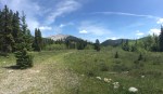
The hike starts out at the Cataract Creek campground (just before entering the campground there is a parking lot to the right. The trailhead starts from here). There are two routes – one straight up to the switchbacks and one that follows the creek. If steepness is an issue, then take the creek route by going right at the fork then down to the creek bed. Follow this until you see orange flagging tape. If you would like a nice forest walk followed by a steep climb up an old fire break (perhaps it was used as a fire break? Not sure. It ends abruptly so we were unsure of why the trees were cut down), then take the left fork. Either path meets up about 30-45 min later just before the switchbacks. These are not steep while in the trees, so if you would prefer to cut them short, there are lots of paths straight up; just be cautious of footing as the forest is mainly moss and decaying logs underneath (I fell through once and twisted my ankle).
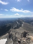
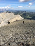
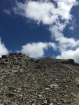
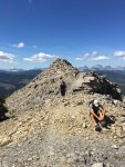
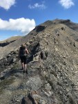
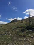
After the switchbacks, the terrain becomes steep. The trees disappear almost instantly and you are left in a field of sorts. The trial has been so well used that it was washed out from frequent traffic and rainfall. There is a new path just to the side that is being created. At this point, the trail is faint; if you follow the pipes out of the ground like some blogs suggest, you end up in some pebbly territory on steep slabs. The best is to traverse across the field until you reach the short ridge walk to get to the last stretch. From the time you leave the trees to the time you reach the old fire lookout, the terrain is steep but not scramble steep.
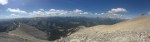
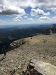
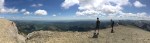
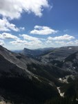
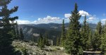
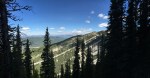
Once at the lookout, the views are amazing (as always). To the West you have the mountains and to the East are the prairies. There is a wildlife reserve to the Southwest that is quite interesting (that will warrant a trip out). There is a road to the top of a plateau that you can drive to. It’s approximately the same altitude as the lookout, so I am curious what is up there, if anything (I didn’t even know there was a road that high!).
On the descent, we took the creek trail and it was a nice change from the constant steep down that we were subjected to. From the 2013 floods, there wasn’t much path close to the creek so at times, we were walking in the dry creek bed (with the sun beating down on us). Once finished, we went to Cataract Creek across the road from the campground and relaxed for a bit, cooling off in the creek (which was ice cold!).
In Summary:
This is a relatively easy hike with some steep sections. It was not busy at all! We only met 2 other people the entire day.